ESTABLISHED 2004
Our Impact
Services Matrix across 7 Sectors
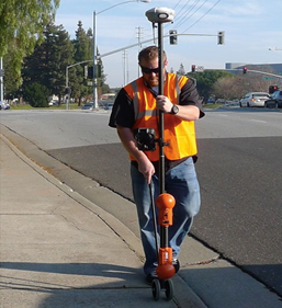
Surveying & Spatial Data Services
Land & Cadastral Surveying, 3D Laser Scanning, Hydrographic Survey, Mobile Mapping, UAV Aerial Survey & LiDAR Mapping, Underground Utility Detection, Geodetic & Control Networks (VRS).
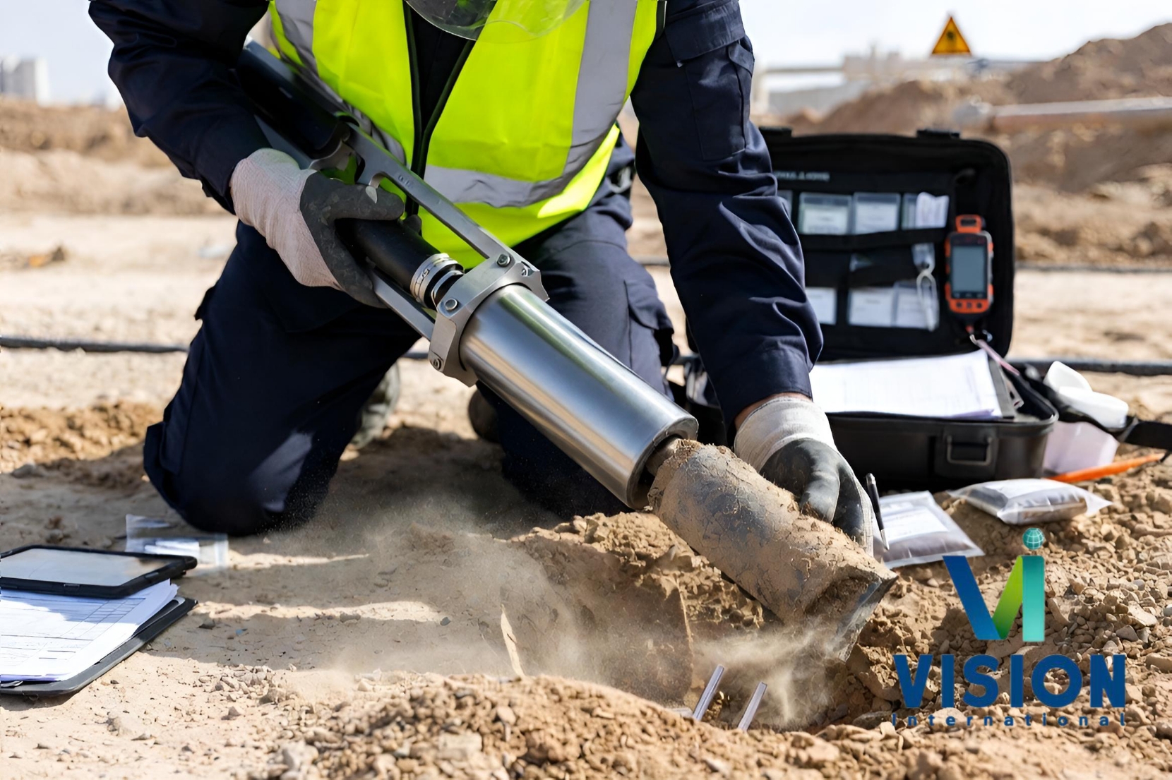
Geotechnical & Subsurface Investigation
Onshore Geotechnical Investigation, Environmental Site Characterization, Offshore & Marine Geotechnical, In-Situ Testing (CPT · SPT · DCP), Geophysical Surveys.
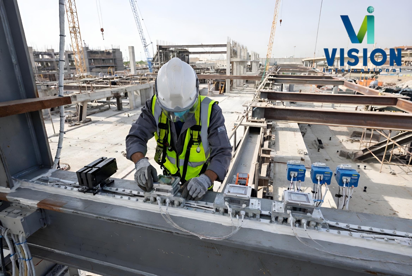
Engineering , Design & Construction
Foundation Engineering & Design, Civil Works · Roads · Earthworks, GIS Consulting & Roadmap, Structural Assessment, Application Development (Web · Mobile).
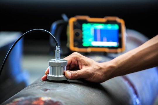
Laboratory, Testing & Inspection
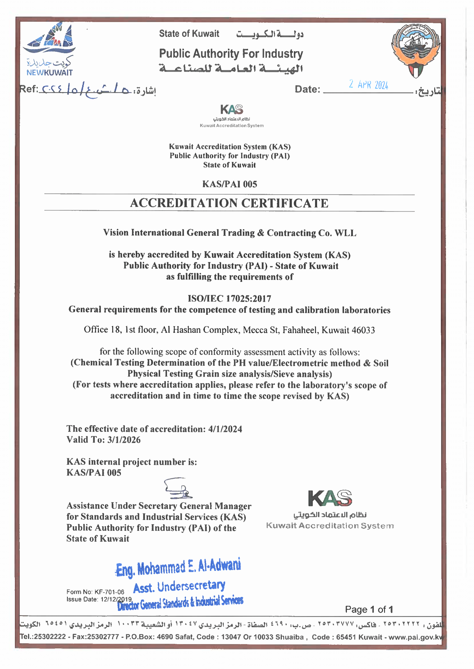
Soil & Aggregate Testing, Chemical & Environmental Testing, NDT — Non-Destructive Testing, Materials Inspection, Asphalt Testing, Calibration Services (ISO 17025).
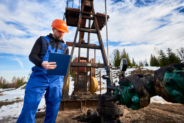
Drilling & Well Services
Soil Boring & Coring, Water Well Drilling, Monitoring Well Installation. Additionally, we deliver comprehensive turn-key water well engineering solutions designed to support industrial development.
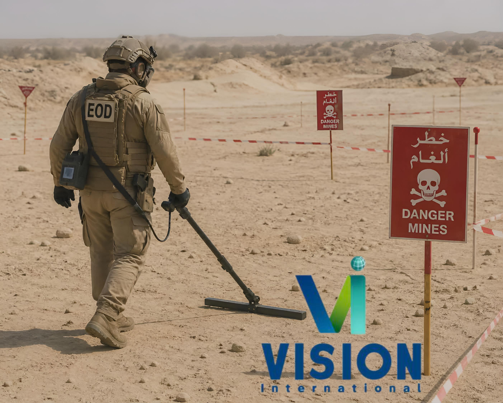
Specialized Safety & Risk Services
UXO / EOD — Survey · Clearance · Risk. Additionally, we deliver comprehensive explosive ordnance disposal and systematic battle area clearance solutions across challenging desert and oilfield.
Equipment , Rental, Manpower & Digital Platforms
Equipment Sales (Trimble & Partners), VRS Network Subscription, Equipment Rental, Vision Connect Platform, Software OEM & Licensing.
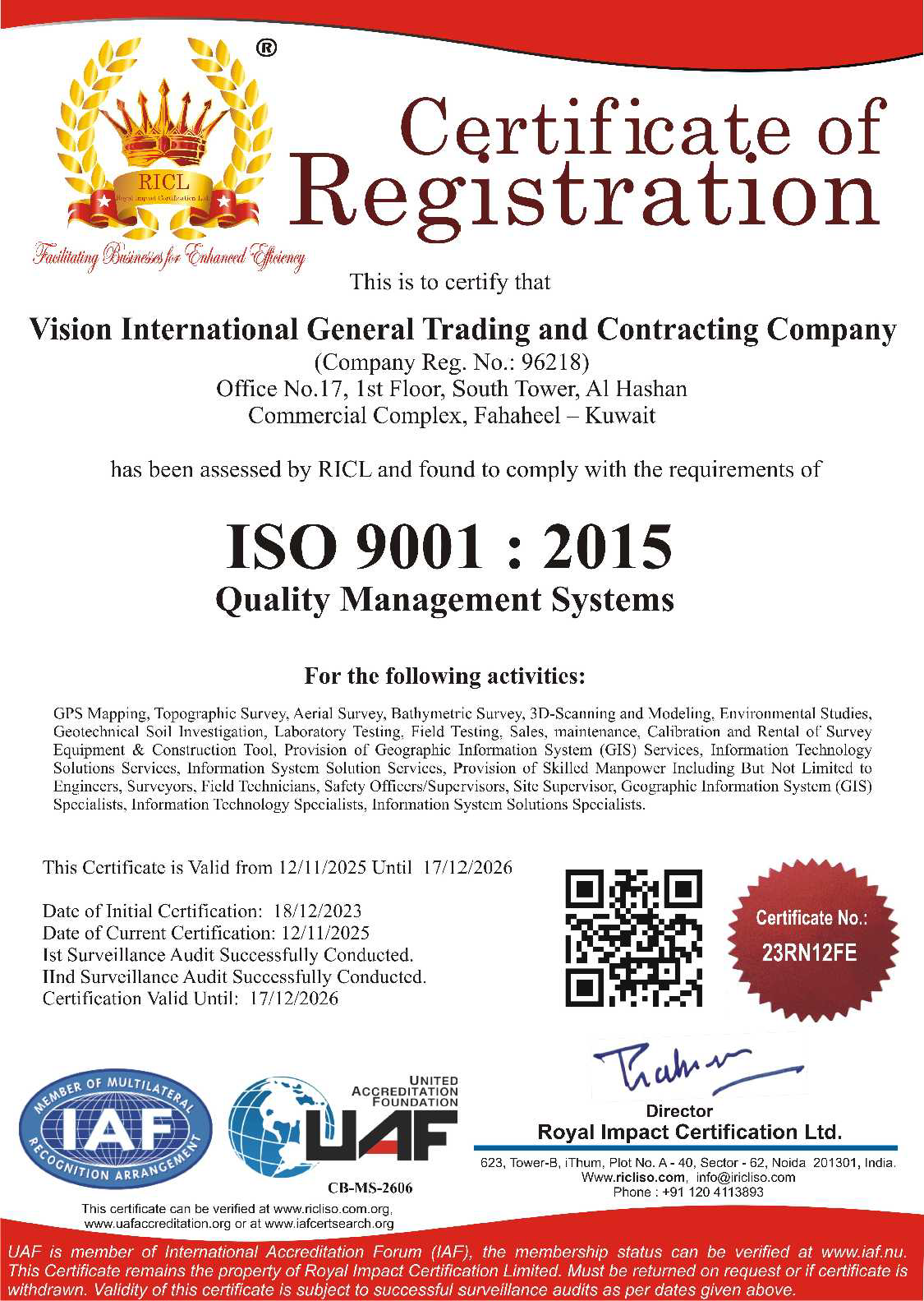
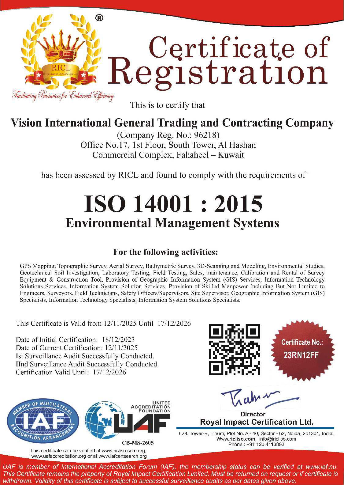
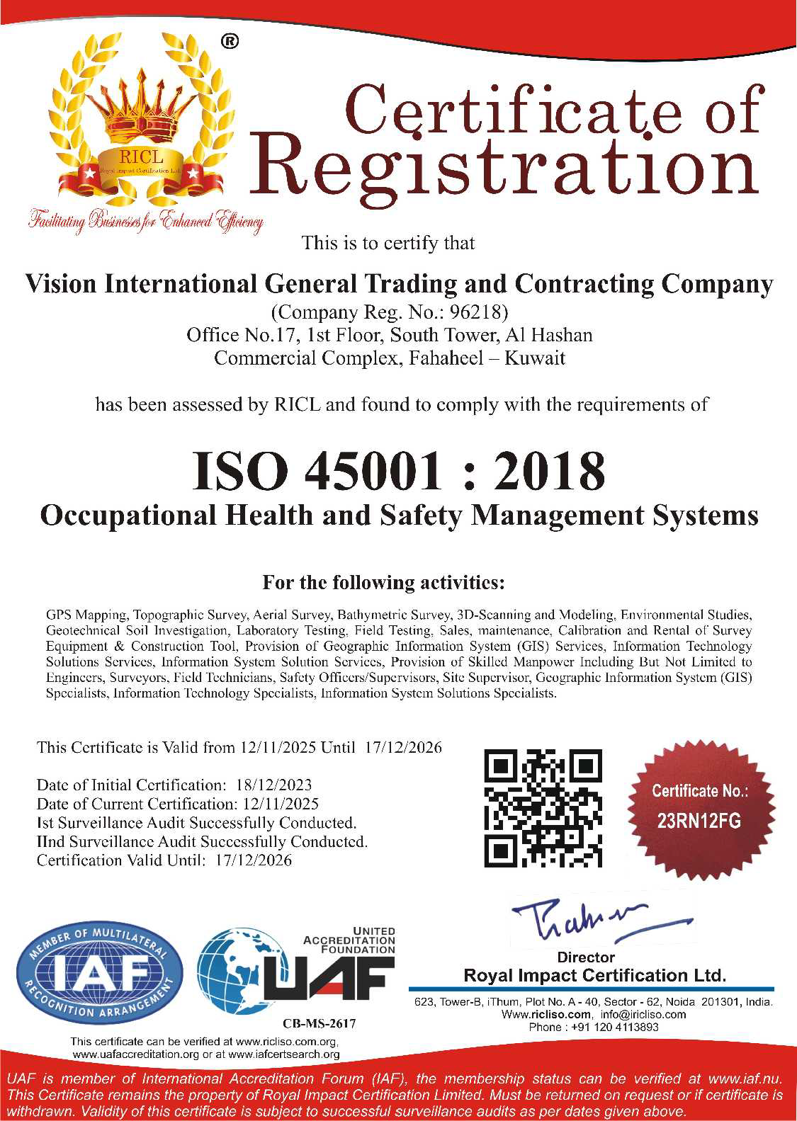
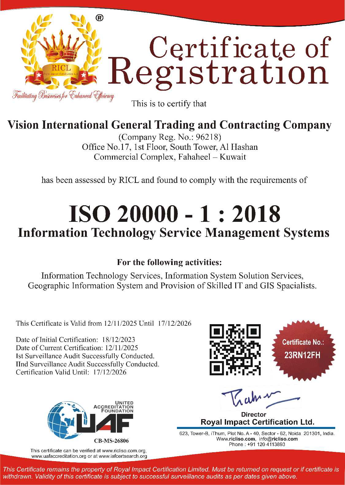
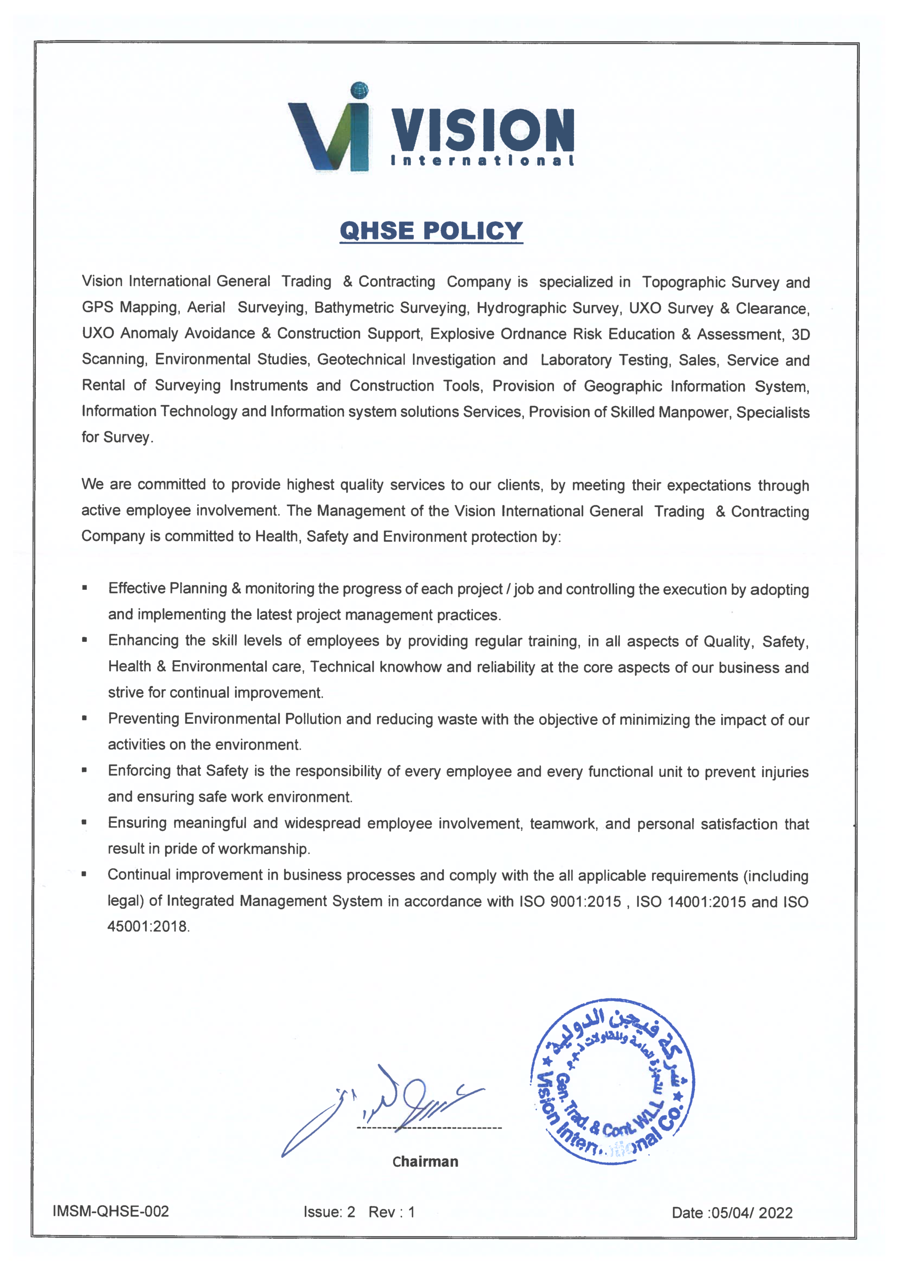
Authority & Compliance


Trusted By