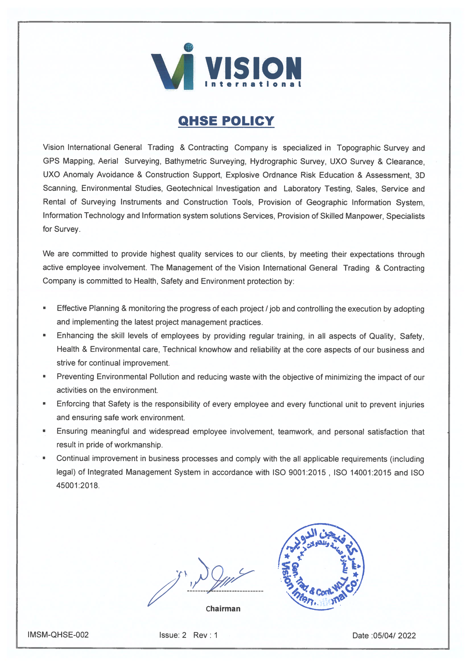
عن الشركة
Mr. Eid Al-Adwani
CHAIRMAN
About Vision International
Vision International commenced operations in 2004 as a specialized engineering services provider in Kuwait. Over the past two decades, our organization has evolved into a trusted multidisciplinary partner for major infrastructure, energy, and corporate developments across the GCC region.
By fusing advanced technology with rigorous technical methodologies, we consistently deliver schedule-driven, cost-effective solutions to complex engineering challenges.Driven by a commitment to execution excellence, our mission centers on providing premium data integrity and engineering precision. We actively support the digital transformation of the regional construction sector, helping clients turn complex physical constraints into manageable digital workflows.
Integrated Technical Capabilities
Instead of forcing clients to manage multiple disconnected contractors, Vision International delivers a completely unified project ecosystem. Our integrated core capabilities bridge the gap between initial ground exploration and final structural verification:
Advanced Surveying & Reality Capture
We execute precise geodetic control networks, topographic mapping, marine hydrographic bathymetry, and high-speed 3D laser scanning.
Geotechnical & Material Science
Our crews perform extensive onshore and offshore site investigations, supported by our fully accredited testing laboratory.
Geoinformatics & Digital Solutions
We build custom GIS portals, location-intelligent mobile applications, and scan-to-BIM digital twins for modern asset management.
Why Leading Organizations Partner With Us
We rely exclusively on our own state-of-the-art fleet of survey-grade dual-frequency GNSS systems, robotic total stations, UAV aerial drones, and geotechnical drilling rigs. Because we maintain complete ownership over our equipment asset base, we guarantee immediate field mobilization availability and flawless machine calibration on every job site.Finally, the true strength of our organization lies in our people. Our field operations are guided by senior geodetic surveyors, certified geologists, GIS developers, and expert data analysts. This deep technical bench ensures that raw field data undergoes rigorous engineering interpretation before transitioning into client hands as a final deliverable.
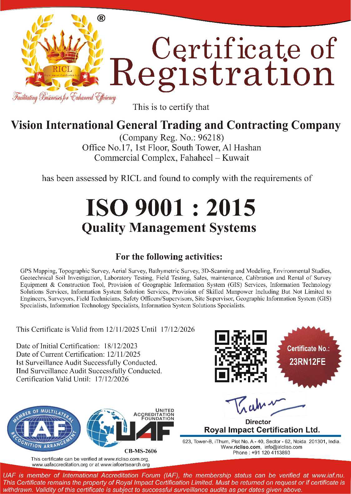
ISO 9001
Quality Management Systems
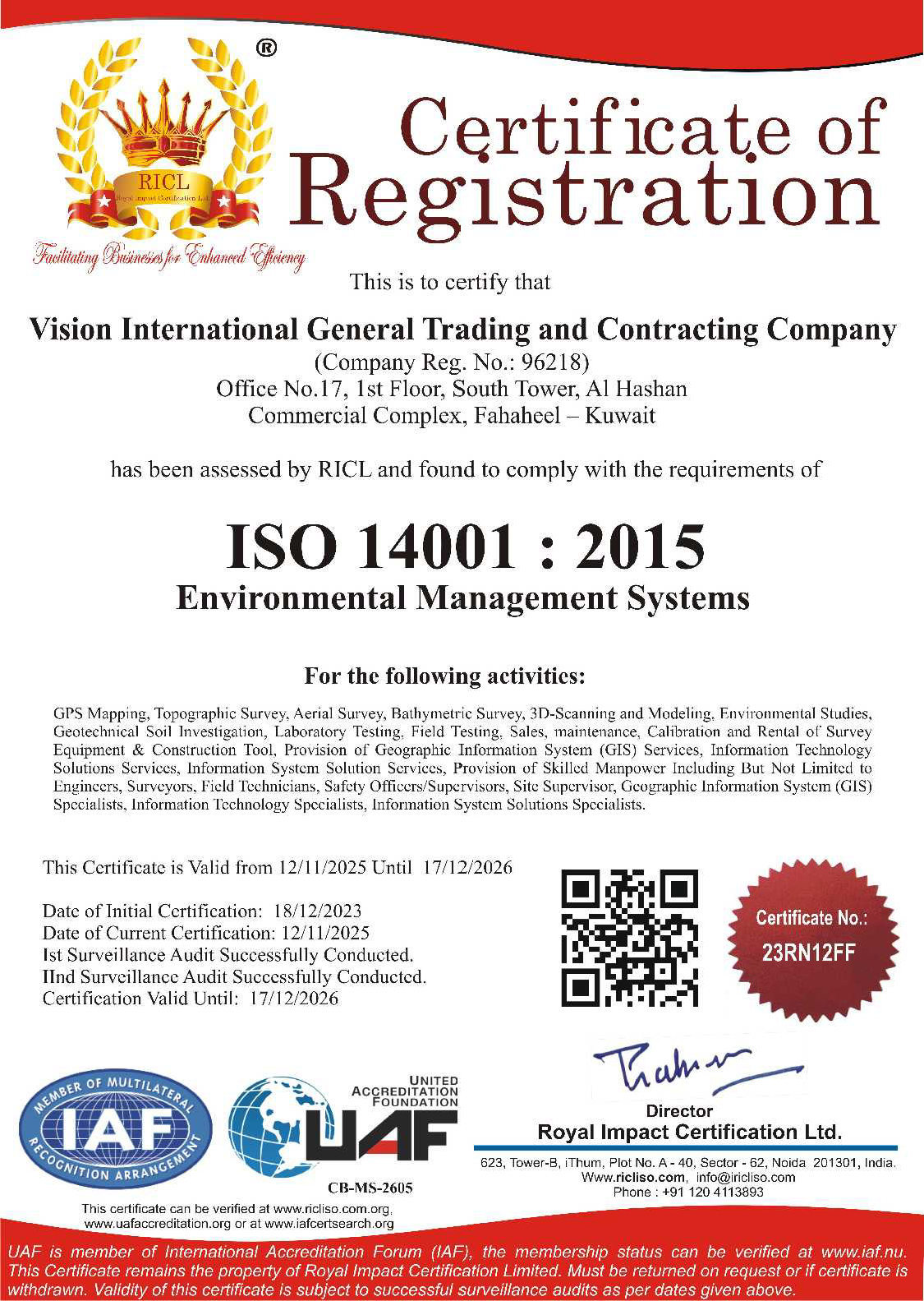
ISO 14001
Environmental Protection
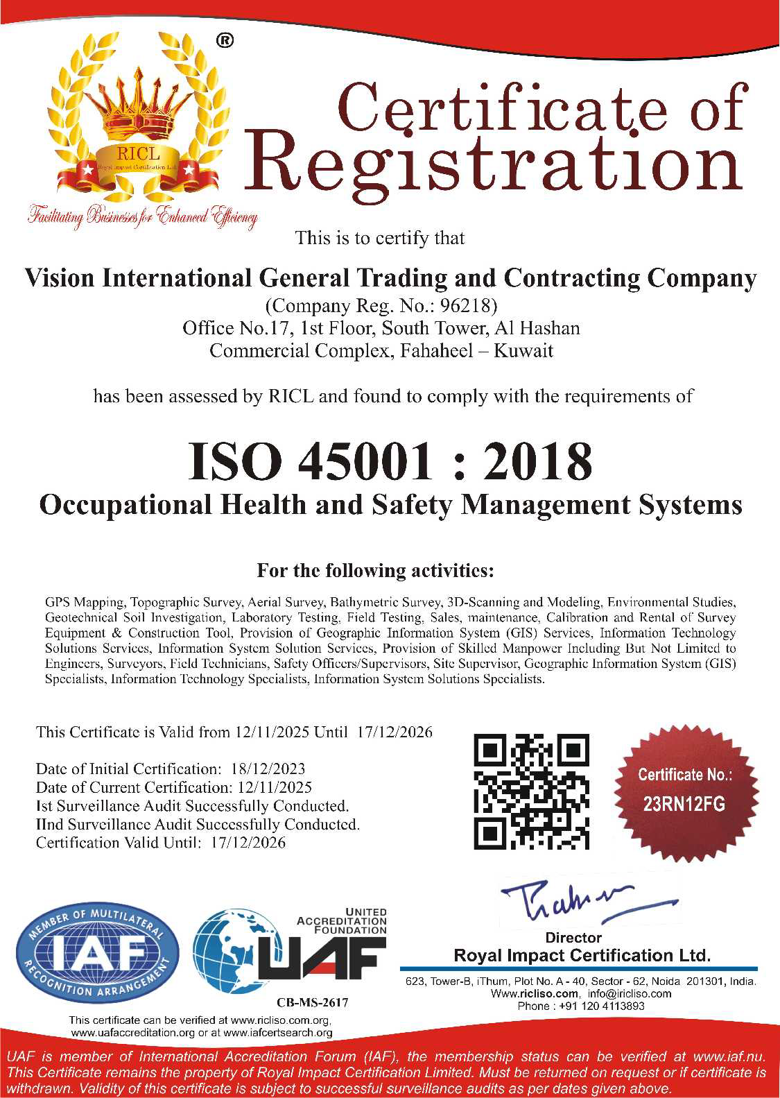
ISO 45001
Occupational Health and Safety
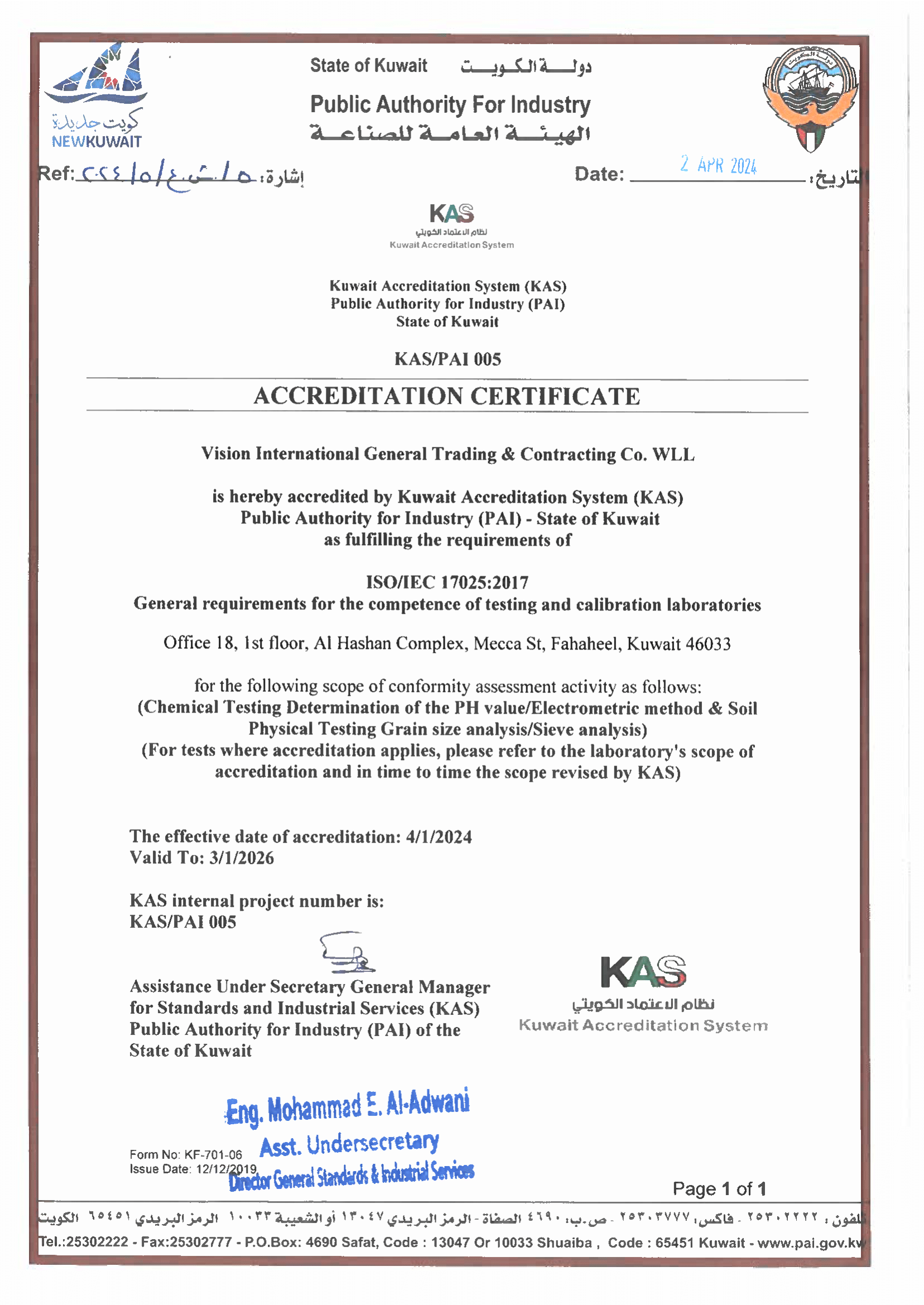
ISO/IEC 17025
Testing & Calibration Competence
Our Core Values
Our primary objective is to maintain a unique and dynamic working environment where clients’ and employees’ needs and aspirations are consistently anticipated, responded to and satisfied. We understand that the key to our success is maintaining a motivated and enthusiastic workforce, and in turn, transferring this ethos across to our clients.
Cost Effective Solutions
Personable Services
Honest & Responsible
Experienced Personnel