Frequently Asked Questions
Need answers before you start your next project?
Explore our most frequently asked questions about Vision International, our services, our technical capabilities, and how we support projects across Kuwait and the GCC. From surveying and geotechnical investigations to GIS, marine services, laser scanning, and engineering support, this page is designed to help you find clear answers quickly and confidently.
Frequently Asked Questions
About Vision International
Vision International is a Kuwait-based engineering services company delivering integrated expertise across surveying, geotechnical investigation, geoinformatics, laboratory testing, engineering, construction, and specialized field services. Since 2004, we have supported major clients across Kuwait and the GCC with technically rigorous, schedule-driven solutions for infrastructure, oil & gas, marine, government, and built-environment projects.
Our registered office and sales office is located at Office 17, 1st Floor, South Tower, Al-Hashan Commercial Complex, Fahaheel, Kuwait, P.O. Box 46033, Fahaheel 46155, Kuwait. We also operate an operations office in Mahboula, allowing us to support projects efficiently across Kuwait.
You can reach us at info@visionkuwait.com for general inquiries and sales@visionkuwait.com for commercial and project-related inquiries. Our published contact numbers are +965 22289778 and +965 96963477, making it easy for clients to connect with our team for technical support, tenders, or new project discussions.
We support clients across oil & gas, infrastructure, marine and ports, industrial developments, buildings and towers, utilities, and government programs. Our integrated service model allows clients to work with one partner across multiple technical disciplines, from early investigation and survey through engineering support and final delivery.
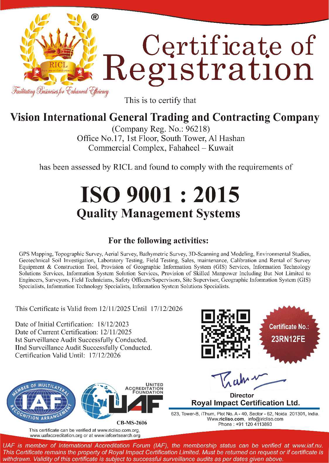
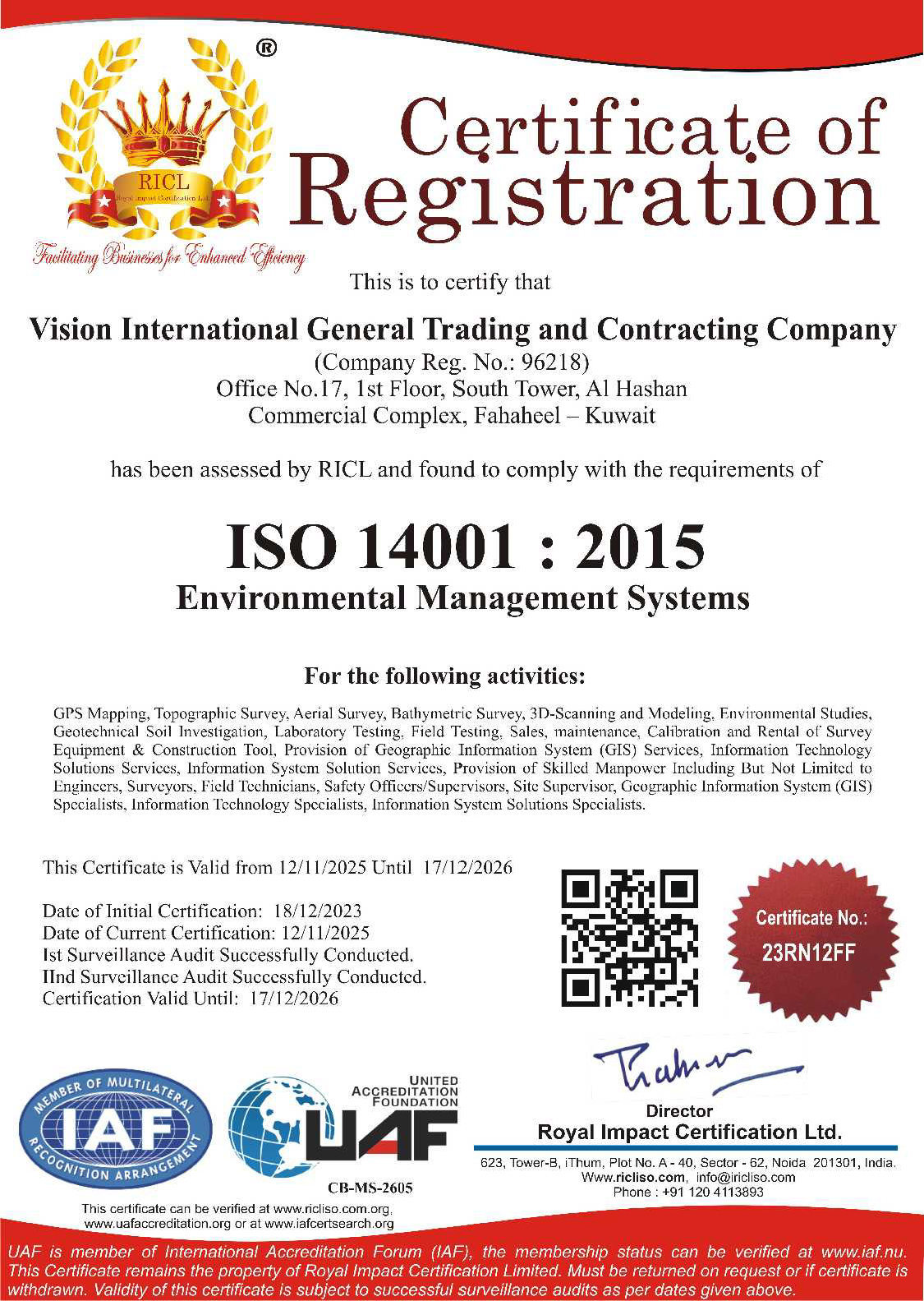
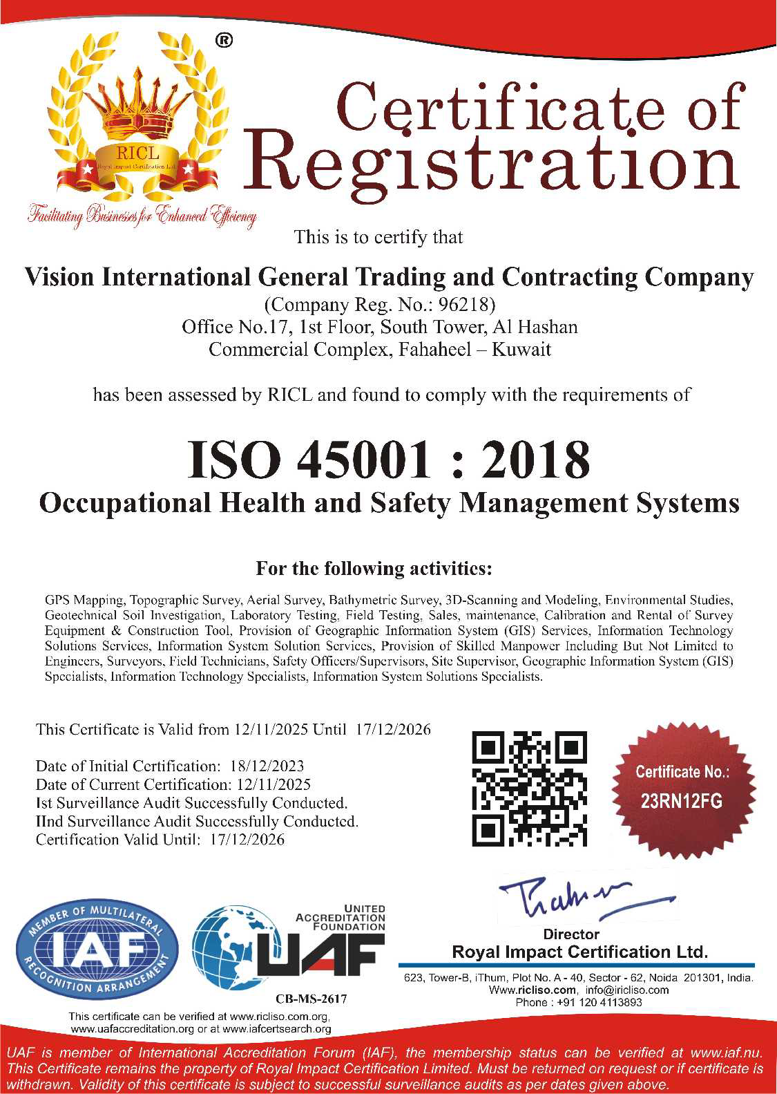
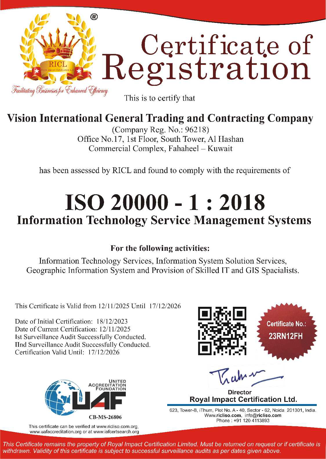
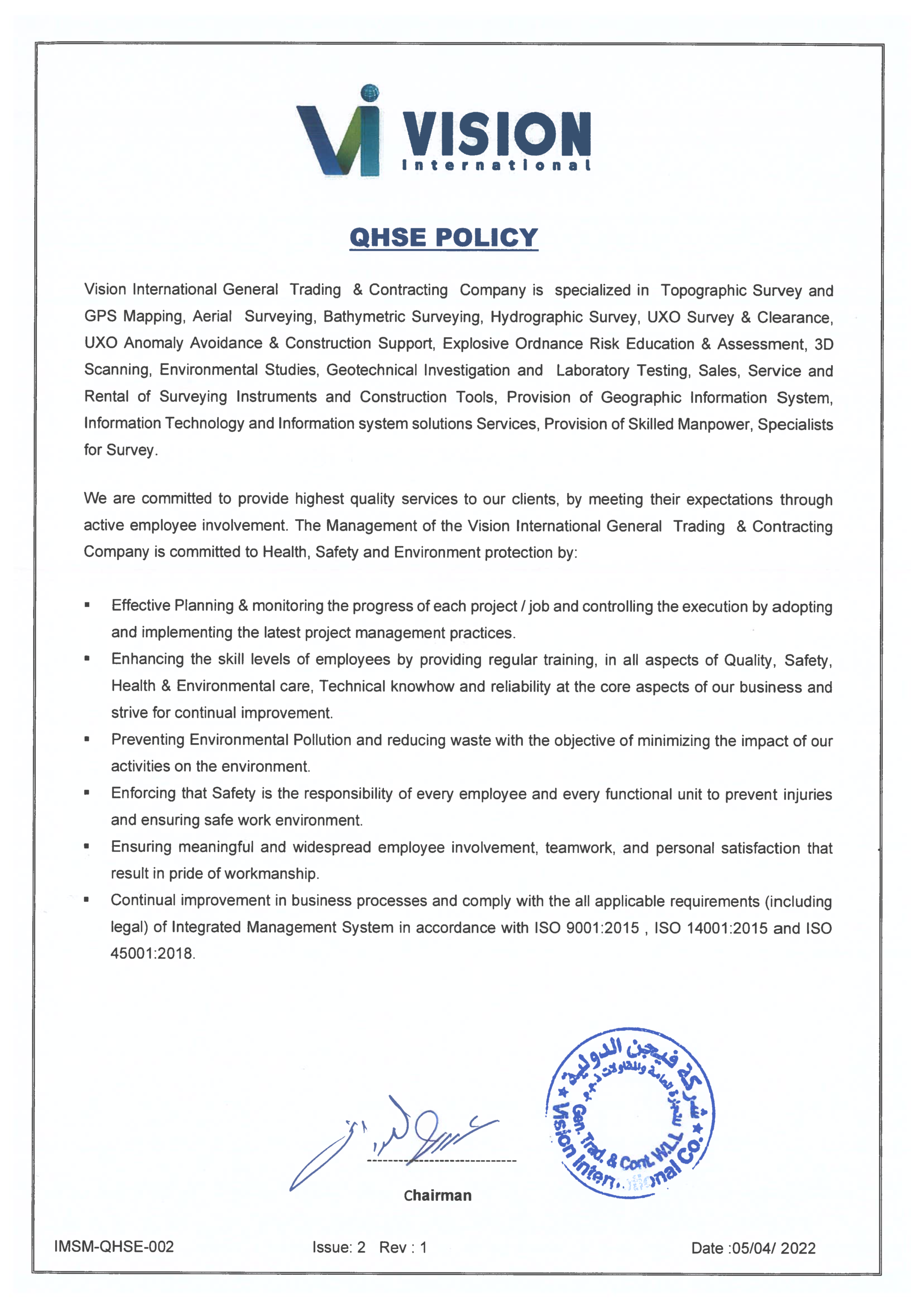
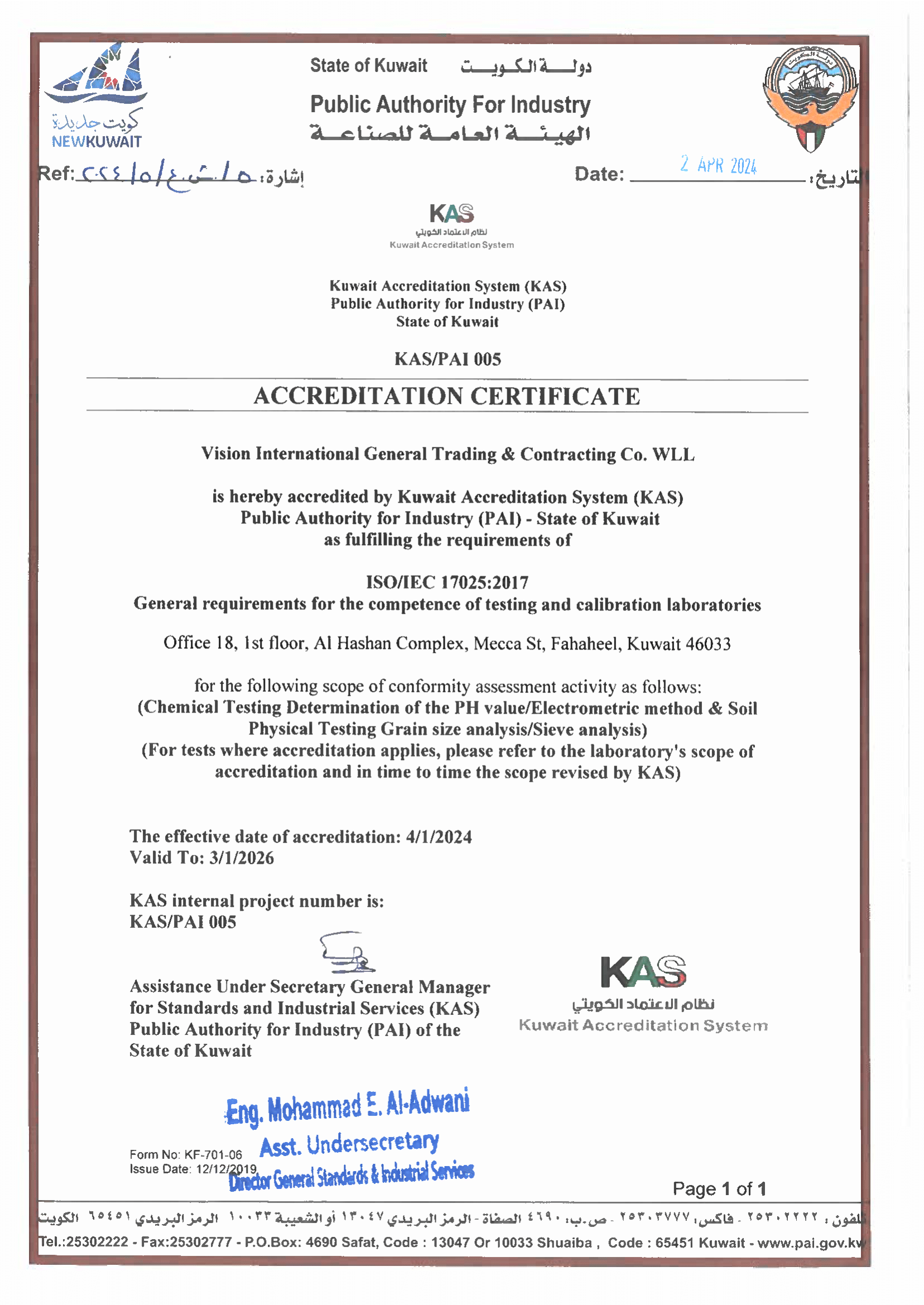
We operate under internationally recognized certifications including ISO 9001, ISO 14001, ISO 45001, ISO 20000-1, and ISO/IEC 17025. These standards reinforce our commitment to quality, safety, environmental responsibility, technical competence, and dependable service delivery across every project we undertake.
Clients choose us because we combine owned equipment, experienced field teams, accredited laboratory capability, and engineer-led delivery under one roof. This integrated model reduces coordination gaps, accelerates schedules, improves accountability, and gives clients confidence that fieldwork, analysis, reporting, and technical support will be delivered to a consistently high standard.
Services & Technical FAQs
For precision land surveying, we recommend survey-grade RTK GNSS systems backed by a reliable correction service. Our Kuwait-wide VRX/VRS correction network supports major GNSS brands and enables high-accuracy positioning for cadastral, engineering, infrastructure, and construction surveying across the country.
Yes. We provide construction setting-out, control networks, dimensional checks, verticality surveys, and final as-built documentation for civil, industrial, and infrastructure projects. Our work helps contractors build with confidence, maintain tighter tolerances, and produce reliable closeout deliverables that stand up to review.
We are structured for rapid deployment. Our published service workflows indicate that RTK GNSS crews can mobilize within 48 hours, UAV aerial mapping teams within 72 hours, and marine or offshore assets on short notice depending on approvals and project scope. This gives our clients the responsiveness needed for fast-track projects and shutdown-critical work.
Our geotechnical testing process begins with project scoping and site investigation planning, followed by drilling, sampling, in-situ testing, laboratory testing, engineering interpretation, and formal reporting. This structured workflow gives project teams the ground data they need to make sound decisions on foundations, settlement, ground improvement, and construction risk.
Effective soil improvement starts with knowing the ground conditions in detail. Depending on project requirements, we may recommend vibro-compaction, stone columns, jet grouting, dewatering, shoring, and post-treatment verification testing to improve bearing performance, reduce settlement risk, and achieve stronger long-term ground behavior.
Yes. We provide offshore and marine geotechnical services including marine boreholes, offshore CPT/CPTu, seabed sampling, and integrated marine survey plus geotechnical investigation. These capabilities support ports, terminals, subsea pipeline routes, shore approaches, offshore foundations, dredging programs, and reclamation projects with a single coordinated technical team.
Marine survey data is essential to safer coastal and offshore construction because it reveals bathymetry, seabed hazards, sediment conditions, route constraints, and underwater obstructions before work begins. This allows us to support smarter design decisions, reduce uncertainty, lower construction risk, and improve execution for coastal protection, dredging, quay walls, marine structures, and subsea infrastructure.
GIS gives planners and decision-makers a stronger foundation for land-use analysis, infrastructure planning, asset mapping, utility coordination, and spatial decision-making. We use GIS to help clients move beyond static maps into connected digital workflows that support better planning, faster analysis, and more informed infrastructure management in Kuwait.
Yes. We build custom GIS portals, web dashboards, mobile field applications, and enterprise geospatial solutions that connect location intelligence with operational workflows. This helps our clients streamline inspections, improve field data capture, integrate systems, and turn geographic data into day-to-day business value.
Laser scanning creates immediate value when used for existing-condition capture, as-built verification, scan-to-BIM, dimensional control, clash detection, and project documentation. We help clients turn highly accurate field capture into practical design, coordination, and asset-management deliverables that reduce uncertainty and improve project efficiency.
Yes. We can automate structural data collection using instrumentation, sensors, wireless dataloggers, GNSS, total stations, telemetry systems, and live dashboards. This gives project teams real-time visibility into movement, deformation, and structural behavior, while reducing manual data handling and improving reporting accuracy.
Yes. We provide piezometers, inclinometers, automated data acquisition systems, telemetry, threshold alarms, dashboards, and long-term monitoring solutions for excavation works, embankments, retaining systems, tunnels, and other critical assets. Our monitoring approach helps clients manage risk proactively rather than reactively.
Yes. We support clients with equipment rental, equipment sales, calibration support, and professional technical training across surveying, GIS, and related field technologies. This makes us a practical partner both for clients who want fully outsourced delivery and for teams building or strengthening their own internal capability.